Drop · water · retardant
A drop prepares a line; it does not replace ground crews
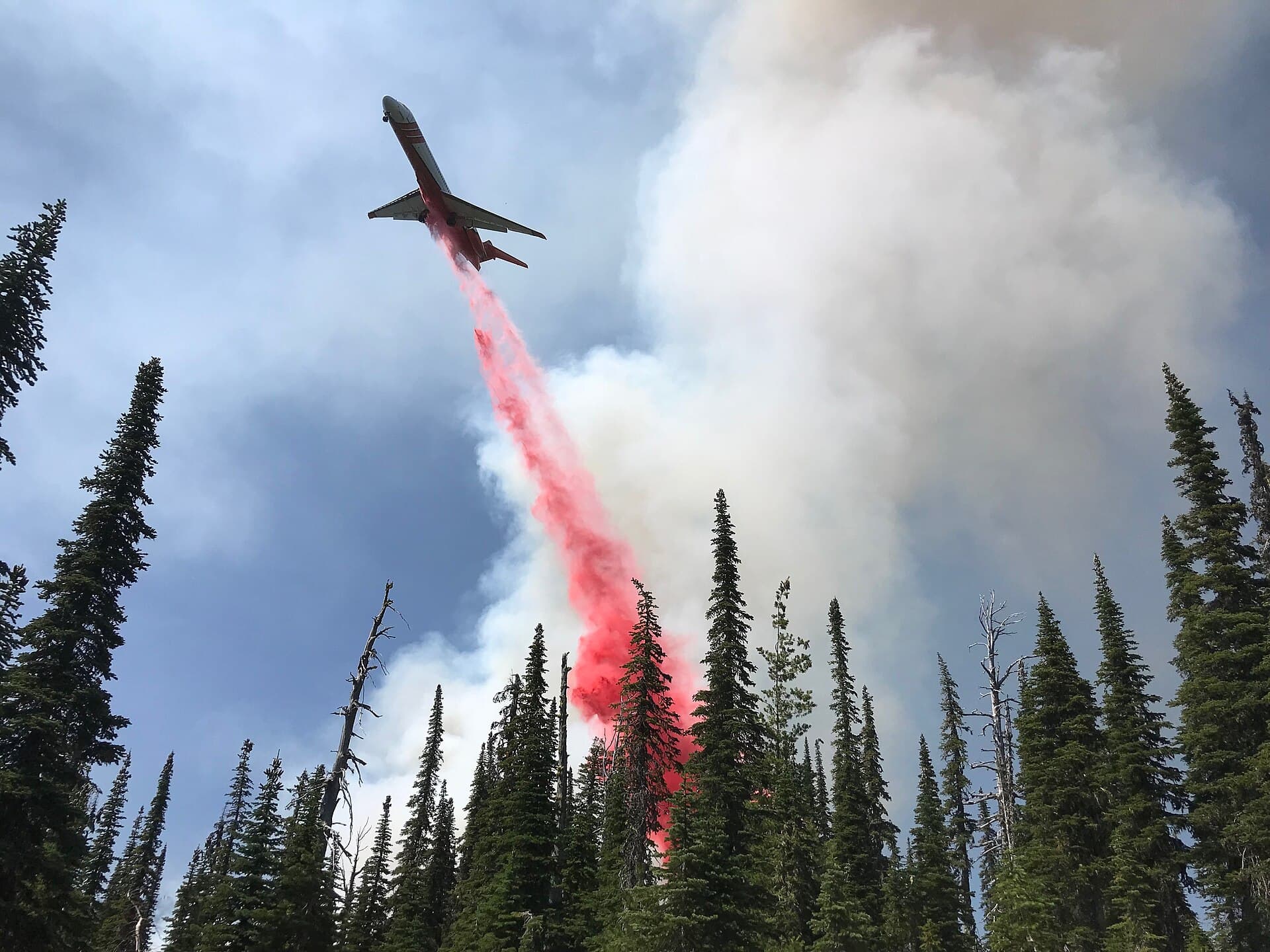
Product, target, height and pass continuity matter as much as volume. A dramatic drop image does not by itself show what effect was achieved.
- Published
- Revised
Short answer
Water absorbs heat quickly but evaporates; foam helps water cover and penetrate some fuels; long-term retardant reduces fuel flammability after the water has evaporated. Amphibious aircraft scoop on a suitable surface, land-based tankers reload on a runway, and helicopters use buckets, snorkels or tanks. All support a tactic coordinated with crews on the ground.
Key points
Water: immediate effect
It cools and wets, with duration limited by heat, wind, vegetation and evaporation.
Retardant: persistent line
It is generally placed ahead of or along a flank to help slow spread and hold a line.
The cycle sets the pace
Distance to water or base, refill time, traffic and target determine the real delivery rate.
Three product families, three operating logics
Water removes energy from the fire and wets fuel. Its impact is immediate but fades as it runs off or evaporates. Foam or wetting agent changes water properties to improve spreading or penetration.
Long-term retardant contains salts that continue to affect fuel after the water evaporates. Its color makes the line visible to crews in the air and on the ground. It is often placed to build or reinforce a line rather than poured indiscriminately onto flame.
Scooping, runway, bucket or hover refill
An amphibious aircraft such as the CL-415 can scoop when water length, depth, approach and clearance are sufficient. A land-based tanker returns to a base where the load is prepared. A helicopter can dip a bucket or draw through a snorkel while hovering.
The nearest water is not always usable. Wind, waves, boats, power lines, terrain, water quality, traffic organization and loaded performance all affect selection.
Pass geometry turns volume into effect
Too high, the product drifts and disperses; too low or concentrated, it can damage vegetation, throw debris and endanger people. Speed, wind, gate opening and slope shape coverage on the ground.
The target may be the active edge, a flank, an anchor point or a line being built ahead. Tactics belong to incident command and airborne coordination, not to the flight path alone.
Ground crews consolidate what air support made possible
A water line can briefly reduce intensity so a crew can advance. A retardant line can slow fire, but convection, embers, a coverage gap or a wind change can carry fire across it.
Crews check for rekindles, build or reinforce line and treat hotspots. Without that continuity, a drop remains temporary intervention.
Common questions
- Why is retardant red?
- Color helps flight and ground crews see where the line was laid and where gaps remain. It fades over time; the retardant components, not the color, provide the main effect.
- Why is product sometimes dropped ahead of the fire?
- A continuous line on unburned fuel can slow the arriving front and support a control line. The choice depends on intensity, terrain, wind and the tactical plan.
- Can someone remain under a drop to film it?
- No. Liquid mass, debris, branches and lost visibility can cause serious injury. Stay outside the operational area and follow authority instructions.
Primary sources consulted
Revised · July 29, 2026